Bushfires and satellites
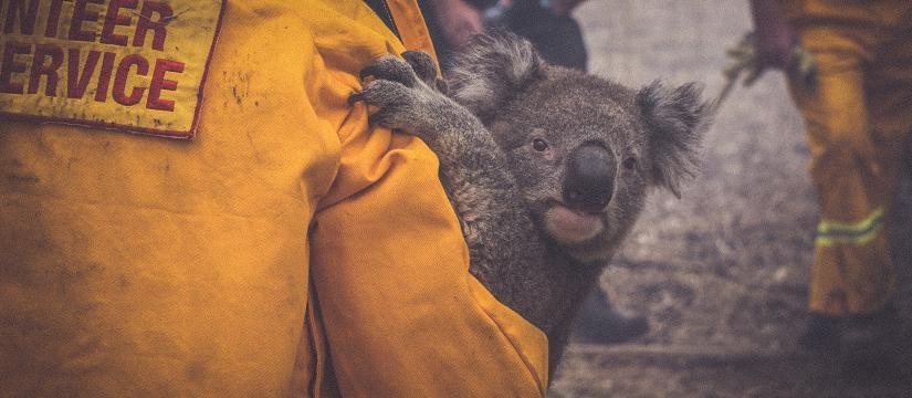
Australia’s apparent lack of preparation to confront the ongoing bushfire crisis seems shortsighted; the next time they flare up, as inevitably they will, it would be unconscionable. As reported this week, our bushfires are happening three times more often than a century ago, while over the same period the country’s population has increased five times.Â
Why was it that our defences against this season’s fires were allowed to be so comprehensively overwhelmed?Â
Why was it that our defences against this season’s fires were allowed to be so comprehensively overwhelmed?Â
The answer requires no nuance. We were scandalously unprepared as was demonstrated by our nation’s leader going on an overseas holiday at the beginning of the crisis, apparently unaware of our lack of readiness. Very few others were any wiser. It is not the time to argue about the causes of the fires, except for those deliberately lit, because our country will always be prone to them, in various degrees of severity.Â
But we need an urgent solution, and it will not be enough to undertake conventional measures before the next onslaught, such as prudent back burning and access clearing in the winter, and deploying more waterbombers, firefighting equipment and personnel, important though they are. We should summon technology to the cause – and the technology exists to provide us with an early warning system, which can be launched before the next fire season. In some ways, it would be reminiscent of the British system that alerted their fighter pilots to the presence of enemy bombers in the Second World War.Â
For Australia’s purpose, the system would operate to remotely sense fires while they are still small enough to be readily suppressed. For years scientists have been developing thermal infra-red sensors that can manage this. They can be deployed in aircraft, drones or on satellites to fly over and map vast areas prone to fires. GPS will pinpoint the relevant locations to within a metre.Â
Gregory Clark, a physicist and former chief operating officer and president of Loral Space Systems, one of the world’s largest satellite manufacturers and operators, is confident we will soon use satellites to detect fires in their early stages. He says all the technology required is available and would be carried on low earth-orbiting satellites, at a height of 600-1000 kilometres. “They are cheap – a million dollars or less.â€Â Only one satellite would be required, though more would improve the frequency of coverage. They would orbit the country every two to four hours, mapping the hot spots. Regrettably, we don’t yet have launching capability. For that, we would have to go to New Zealand. But a better way would be to establish our own. In any case, we should have done that years ago.
These sensors detect long-wavelength bands of light (beyond the range of human vision) emitted from the Earth, whose intensity depends on surface temperatures. In mineral exploration, for decades geologists have used this science, called thermal infra-red spectrometry. It’s deployed in airborne surveys to map rock types identified by their heat signatures. Small fires obviously would be more readily detectable. It should be possible to establish an integrated early warning system consisting of real-time observation by thermal infra-red sensors continuously revolving at height over fire-prone territory, a downloading capability to a command and control centre which analyses the data, and a communications system that alerts the firefighters.
So far, no country has put into widespread operation such a system, although much work has been done. We could be first. Which would be only right because we have the greatest need. Hopefully, in the event that a Royal Commission or national inquiry into the bushfires is set up, such satellites will be part of its consideration. This system could be operated by the CSIRO in conjunction with the Australian Space Agency. But private enterprise would play a significant role and is already showing interest.Â
Today our general early warning system is based on forecasts, but we do not detect many fires early enough. An indication of the likely cost-benefit is Prime Minister Scott Morrison’s pledge last week of $2 billion for a National Bushfire Recovery Agency which will provide grants to farmers and small businesses and help to rebuild roads, bridges and telecommunications infrastructure lost in recent weeks. Affordable satellite technology is available that might help save lives, houses, businesses and properties.  Not a week before Morrison’s $2 billion pledge the United States used similar technology to target an Iranian general in a moving car hundreds of kilometres away.
It’s not the future. It’s here.Â